14.3 Point
14.3.1 Must coincide with
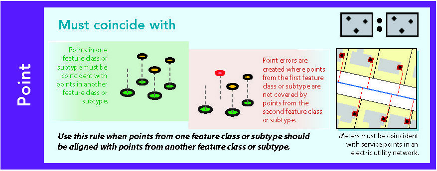
Figure 14.27: Source: Esri (2011)
14.3.2 Must be disjoint
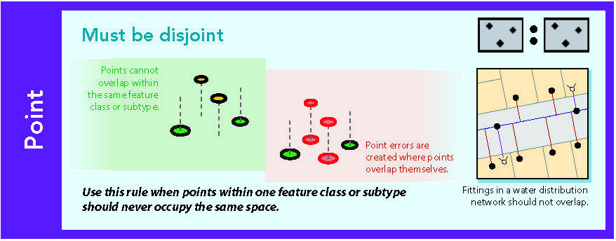
Figure 14.28: Source: Esri (2011)
14.3.3 Must be covered by endpoint of
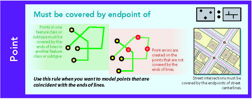
Figure 14.29: Source: Esri (2011)
14.3.4 Point must be covered by line
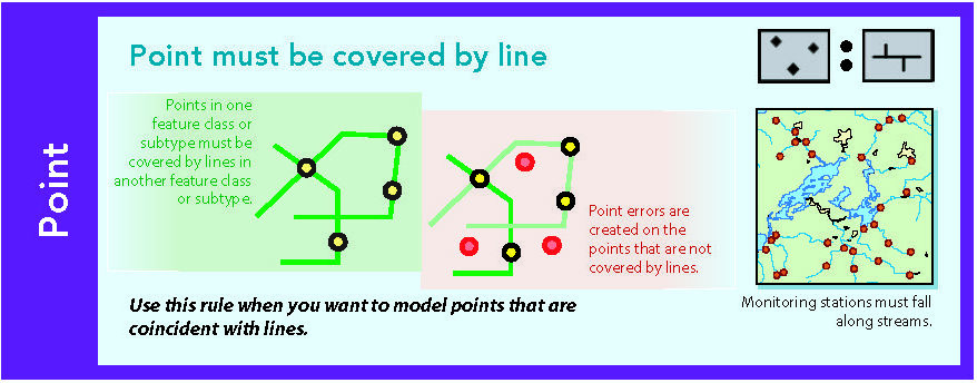
Figure 14.30: Source: Esri (2011)
14.3.5 Must be properly inside
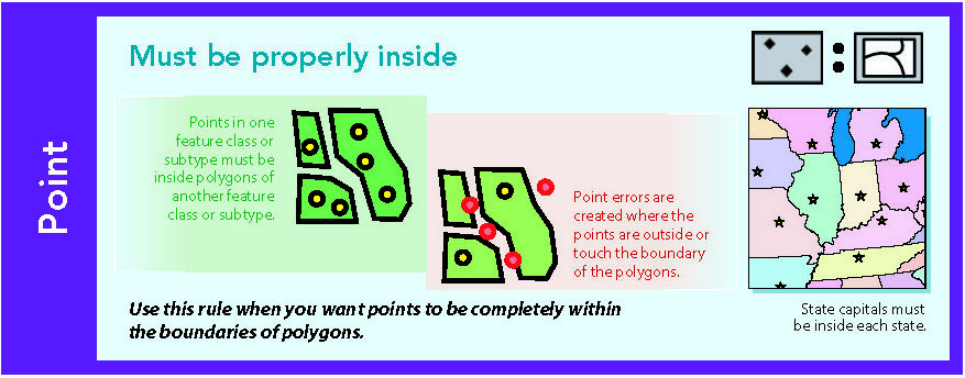
Figure 14.31: Source: Esri (2011)
14.3.6 Must be covered by boundary of
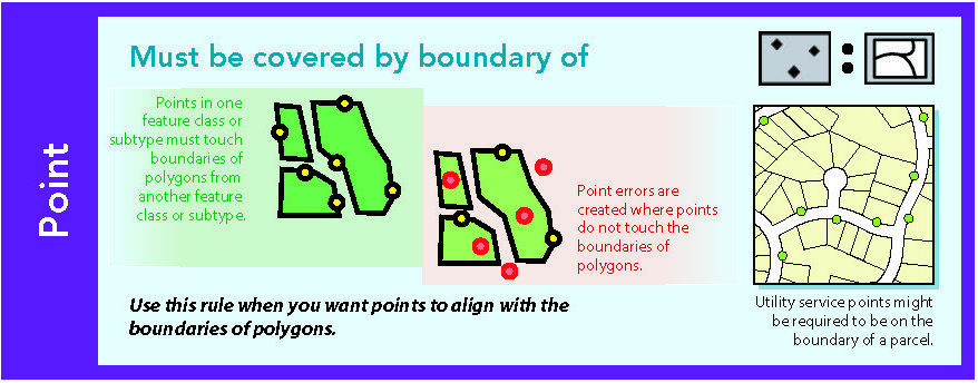
Figure 14.32: Source: Esri (2011)